02 Jun 2024
Possibly the toughest half marathon in the UK, and the most awe-inspiring. The route takes you through ancient woodland, past stunning glacial lakes, historic trails, and challenging mountainous terrain, including the summit of one of Snowdonia's most iconic mountains, Cadair Idris.
- Distance: 13.1 miles
- Height gain: 1165m
- Terrain: 65% trail, 25% mountain path, and 10% tarmac
2024 Results
| 2024 Results.pdf |

Overall
- Dylan Walton
- Chris Smith
- Steve Jones
- Katie Beecher (new female CR)
- Brigitta Deak
- Alice Jones
- Ian Roche
- Peter Fleming
- Ali Hardaway
- Jean Ashley
- Sarah Gooda

| Cadair_X_Route.gpx |
Results
Cadair X is an UTMB Index Race. The benefits of this are listed here.
A descending Gary of Cerist Triathlon Club
THE ROUTE
GPX File
The route will be marked with arrows. We also recommend downloading the GPX file to your device/watch.
| Cadair_X_Route.gpx |
DESCRIPTION
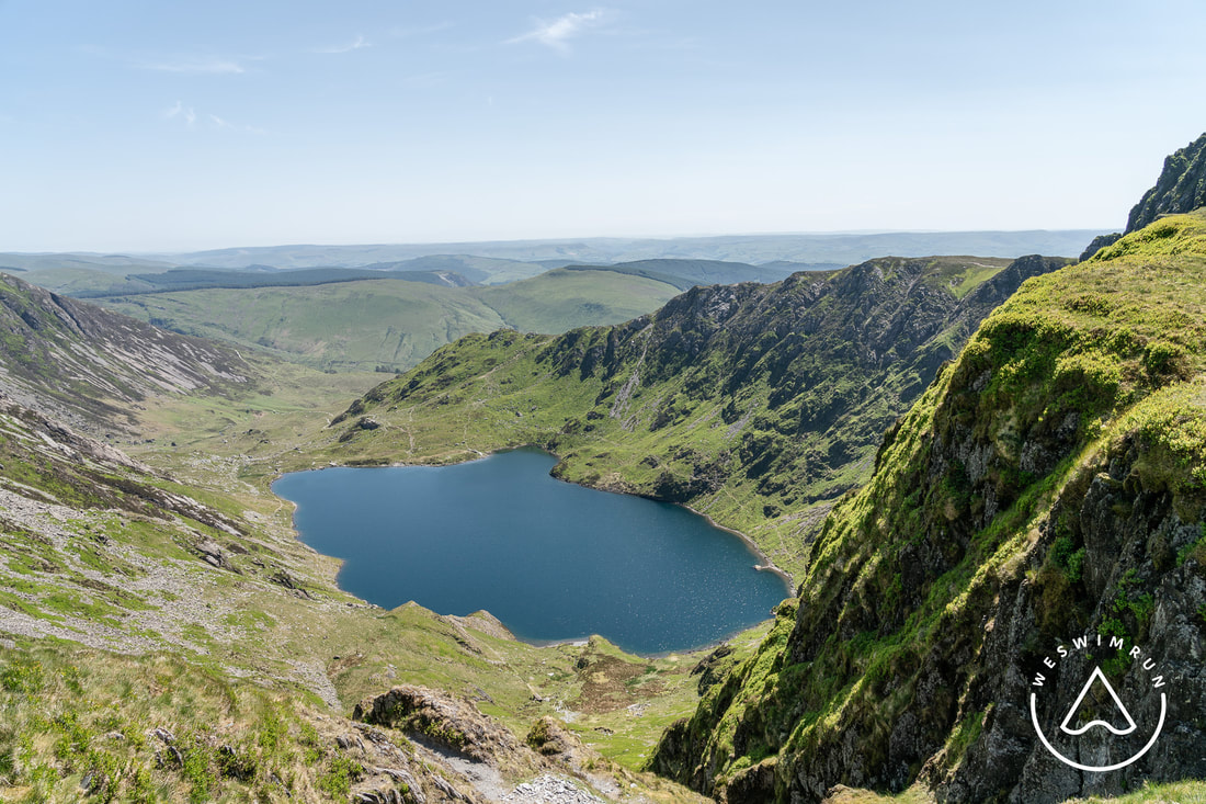
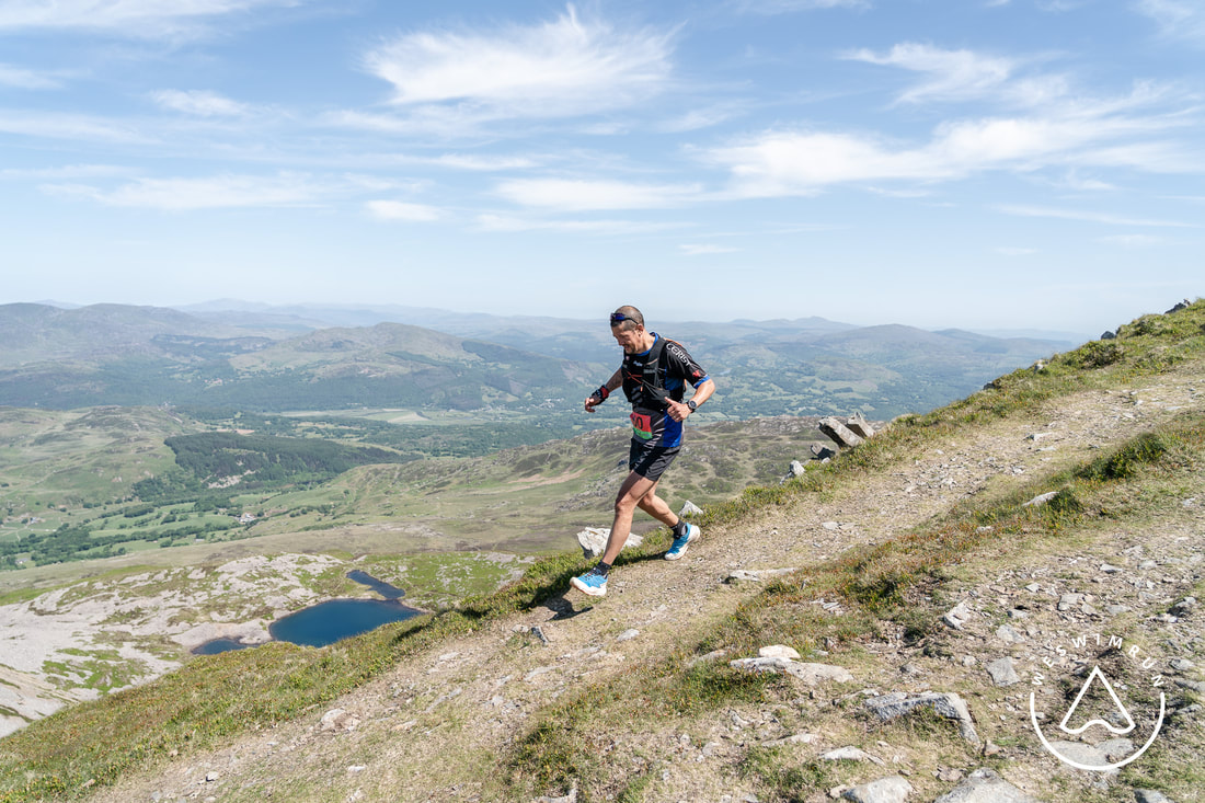
You will run through the tranquil woodland of Dol Idris and then up steeply through the wooded gorge. As you ascend out of the trees you may clasp glimpses of the stunning glacial lake Llyn Cau to your left. You will continue your ascent towards Mynydd Moel before traversing west and ascending to the summit of Cadair Idris, 893m.
The section between 1km and 3km involves a sustained ascent. It's one of the steepest starts to any race.
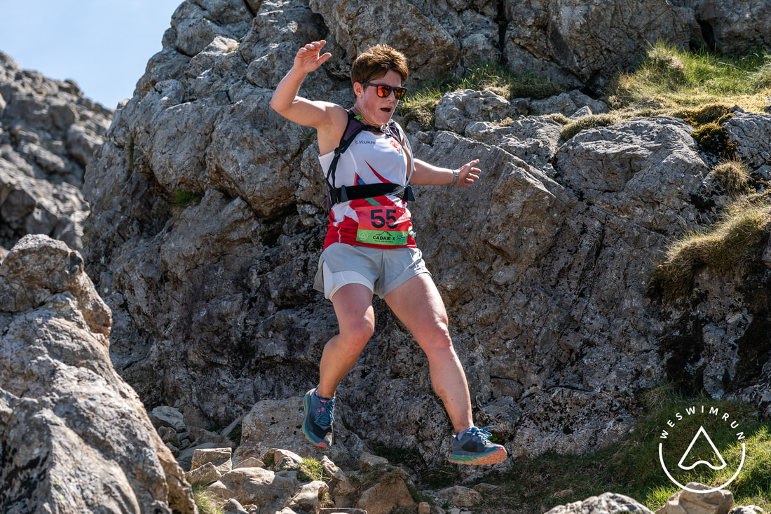
The most challenging underfoot terrain is just after the summit of Cadair Idris. Take care on this descent.
Once off the rocky terrain of the summit your descent will follow the established Pony Path before turning south west down towards Tyn Y Fach and Mary Jones' Chapel.
You will then follow a beautiful, less-travelled section of the Mary Jones walk before traversing North East through tranquil woodland tracks, secret waterfalls and back along a country track parallel to the north side of the stunning glacial ribbon lake, Tal Y Llyn, before returning to Cadair Tearoom for some well earned rest.
Interactive map here.
The section between 1km and 3km involves a sustained ascent. It's one of the steepest starts to any race.
The most challenging underfoot terrain is just after the summit of Cadair Idris. Take care on this descent.
Once off the rocky terrain of the summit your descent will follow the established Pony Path before turning south west down towards Tyn Y Fach and Mary Jones' Chapel.
You will then follow a beautiful, less-travelled section of the Mary Jones walk before traversing North East through tranquil woodland tracks, secret waterfalls and back along a country track parallel to the north side of the stunning glacial ribbon lake, Tal Y Llyn, before returning to Cadair Tearoom for some well earned rest.
Interactive map here.
ROUTE VIDEO
KIT
Your usual hill running kit must include:
- Waterproof or windproof jacket
- *Race-cup (for aid stations, available to buy for £3)
- Whistle
- Fully charged mobile phone
- Suitable running shoes for mountain terrain
In the event of severe mountain weather we'll use our Plan B route.
The Plan B route is in itself such an awesome route in it's own right.
The Plan B route is in itself such an awesome route in it's own right.
SCHEDULE
Race HQ: Cadair Tea Room
- 09:15-10:15: Registration
- 10:30: Race start
- 12:30: Expected first finisher
- 14:30 Expected last finisher
CHECK POINTS
Distance from start, and altitude:
- CP1: 4.1km, 893m - cut off 1h 30m after start
- CP2: 7km, 560m - water
- CP3: 12.5km, 25m - water + energy
- CP4: 16km, 95m - water + energy
GUIDED DAYS
We will be offering guided reconnaissance days so participants can experience the full route in advance, guided by Race Director Mike Alexander.
On these recce days we will aim to complete the full route in 3hrs. Very roughly equivalent to a regular half marathon pace of 1h 45m.
Subscribe to our mailing list for dates & further details.
On these recce days we will aim to complete the full route in 3hrs. Very roughly equivalent to a regular half marathon pace of 1h 45m.
Subscribe to our mailing list for dates & further details.
CAMPING/PARKING
There is parking & toilets in Dol Idris Car Park, and all day parking and camping at Dol Einion Campsite.

Once the big climb is done you can let fly
COURSE RECORDS
- Richard Shephard 2:01:20 (2023)
- Helen Skipper 2:30:53 (2023)

By pure coincidence, Richard & Helen lined up side by side at the start of the 2023 race. A couple of hours later they smashed the CRs